HMCS Yukon
From Royal Canadian Navy destroyer to San Diego's signature wreck dive

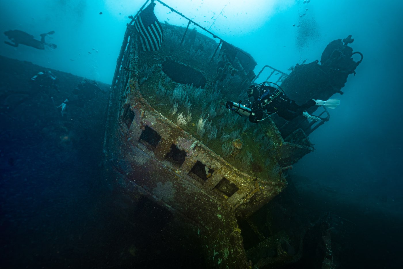
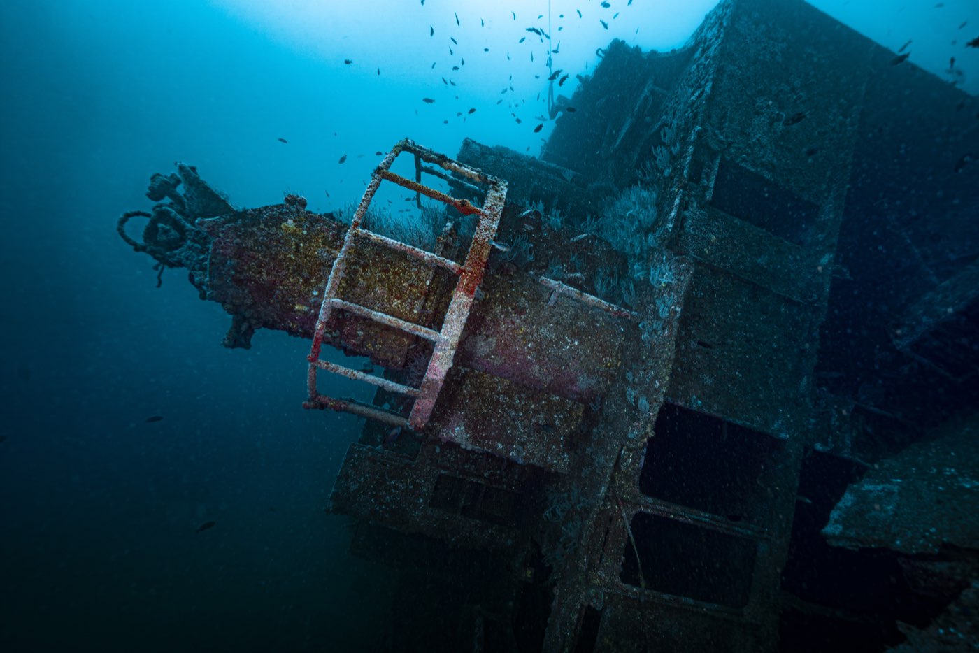
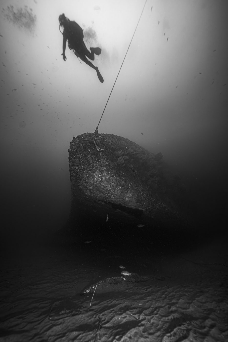
HMCS Yukon is a 366-foot Canadian destroyer lying on her port side in 102 feet of water about 1.85 miles off Mission Beach, San Diego, at the north end of Wreck Alley. She was built at Burrard Dry Dock in North Vancouver, commissioned on 25 May 1963, paid off on 3 December 1993, and bought by the San Diego Oceans Foundation to become the first ship in a new underwater recreation area. She was meant to go down upright on Saturday 15 July 2000 in front of a spectator fleet. A southern swell put her on the bottom a day early, on her side, with no charges fired. Her exposed starboard rail now sits around 56 to 60 feet, and she is the centerpiece of every Wreck Alley trip the Marissa runs.
This page is the long version of that story, built from the project's own documents: the 1999 Environmental Impact Report, the 2000 Artificial Reef Conference proceedings, the Foundation's volunteer manuals, the 2002 Navy sonar survey, the 2005 Scripps ecological assessment, the 2005 UCLA economic study, and the account of the man who mapped her. Where a figure is contested or unknown, this page says so. Every photograph carries the name of the diver who took it.
At a glance
| Class | Mackenzie-class destroyer, Royal Canadian Navy (the Navy's own designation was destroyer escort, DDE) |
| Pennant number | DDE 263 |
| Namesake | The Yukon River |
| Builder | Burrard Dry Dock Co., North Vancouver, B.C. |
| Keel laid | 25 October 1959 |
| Launched | 27 July 1961 |
| Commissioned | 25 May 1963 |
| Length | 366 ft (111.6 m) |
| Beam | 42 ft (12.8 m) |
| Height | About 80 ft from keel to the top of the superstructure after roughly 20 ft of signal mast was cut off |
| Hull | Steel plate, 3/8 inch. Aluminum superstructure and upper decks |
| Displacement | 2,880 tons full load |
| Speed | 28 knots |
| Decommissioned | 3 December 1993 |
| Bought by | San Diego Oceans Foundation, from the Artificial Reef Society of British Columbia |
| Arrived San Diego | 6 May 1999, under tow |
| Sunk | 14 July 2000, a day ahead of the planned ceremony |
| Where | About 1.85 miles west of Mission Beach, San Diego Underwater Recreation Area, immediately north of the original Wreck Alley cluster |
| Orientation | On her port side, bow pointing north |
| Depth to the sand | About 102 ft (31 m) |
| Shallowest point | About 56 to 60 ft (17 to 18 m), the exposed starboard rail and bridge, varying with tide |
| Diver openings | 116 cut into the hull and decks, each marked with a numbered sign |
| Who owns her | The seafloor belongs to the City of San Diego. The reef is administered by the California Department of Fish and Wildlife |
| Protection | None. The site is open to recreational and commercial fishing, including lobster traps in season |
Part One: Built for the Cold War (1959 to 1993)
HMCS Yukon was one of four Mackenzie-class destroyers the Royal Canadian Navy ordered at the end of the 1950s, with sister ships HMCS Mackenzie (DDE 261), HMCS Saskatchewan (DDE 262) and HMCS Qu'Appelle (DDE 264). The Navy's paperwork classed the ships as destroyer escorts, which is what the DDE in the pennant number stands for, and the project documents used that term. In size, armament and role she was a destroyer, and that is what this page calls her. The class refined the earlier St. Laurent design, and its job was anti-submarine warfare in a North Pacific and North Atlantic that were filling up with Soviet submarines.
Her keel was laid on 25 October 1959 at Burrard Dry Dock in North Vancouver, British Columbia, the yard that also built her sister Saskatchewan. She went into the water on 27 July 1961 and was commissioned on 25 May 1963 as DDE 263, the first Canadian warship to carry the name of the Yukon River. One Foundation document gives the commissioning date as 26 May. The one-day gap has never been resolved and does not matter to anyone but a historian.
As built she displaced about 2,880 tons full load, ran 366 feet on a 42-foot beam, and made 28 knots on two English Electric geared steam turbines fed by Babcock and Wilcox boilers. The hull was 3/8-inch steel plate. The superstructure and upper decks were aluminum, a detail that would matter forty years later when volunteers started cutting holes in her.
Yukon first sailed to Halifax with an east-coast crew and served with the Atlantic fleet, then transferred to the Pacific in 1964 and 1965 to join the First Canadian Escort Squadron. Her home for the rest of her career was CFB Esquimalt, outside Victoria. She spent much of that career as a training ship rather than a front-line unit, which is why her complement ran well above the roughly 228 regular crew: up to 170 to 210 trainees could be aboard at a time. A photograph in the Foundation's files shows her leaving San Diego for exercises in 1963, with Point Loma behind her. Her last visit to this harbor, 36 years later, would be under tow.
Between 1984 and 1985 she went through the Destroyer Life Extension refit, the DELEX program that carried the Mackenzie class into the last years of the Cold War. She kept training sailors out of Esquimalt through the late 1980s and into the 1990s. HMCS Yukon was paid off on 3 December 1993, after just over thirty years of service. One lower-authority ship history gives 31 July 1992, which is the date her sister Qu'Appelle was decommissioned and is almost certainly a mix-up.
A handful of service stories turn up in single sources and have not been confirmed by a second: an escort for the royal yacht Britannia during a mid-1960s tour, a 1970 Pacific deployment with Mackenzie and the supply ship Provider that called at Japan, and a collision with the carrier USS Kitty Hawk on 17 January 1983 that damaged her mast. They are worth chasing. They are not worth repeating as fact.
Part Two: A second life takes shape in British Columbia (1991 to 1997)
Yukon's path to San Diego began with a different ship and a different country.
In 1991 the Artificial Reef Society of British Columbia, then a small group of volunteer divers with no commercial diving connections, sank its first vessel, the 185-foot freighter GB Church, inside a provincial marine park. A month later, in September 1991, the Society acquired the first of what would become five retired Canadian naval escorts: HMCS Chaudière, from an earlier destroyer class. Sinking the Chaudière off Sechelt became a small-town fundraising campaign, and it taught the Society hard lessons about diver safety, money and the logistics of making a warship safe for divers. Rodale's Scuba Diving magazine later named the Chaudière one of the twenty best wreck dives in the world.
In 1994 the Society's president, Tex Enemark, negotiated an option with the Canadian government, which was retiring the whole Mackenzie class in a short window, to buy four sisters: Yukon, Mackenzie, Columbia and Saskatchewan. Prices ran between CAN$150,000 and CAN$200,000 per ship. The Society financed the purchases with an interest-free loan from Western Economic Diversification Canada, a federal regional-development agency, and planned to use the scrap value stripped from each ship to pay for preparing the next one.
From the Chaudière the Society had a rule of thumb. Cleaning one of these destroyers to Environment Canada's ocean-disposal standard took about 8,000 volunteer hours and roughly CAN$300,000 for towing, tools and supervision. Environment Canada wrote that standard down in February 1998, with a former Canadian Navy commander and marine engineer, Darryl Hansen, drafting the bulk of it. It would become the document San Diego's regulators leaned on.
HMCS Mackenzie went down off Sidney, B.C. on 16 September 1995. HMCS Saskatchewan followed off Nanaimo on 14 June 1997. Both sank upright, bow first, in a controlled sequence of shaped charges, the way Yukon was supposed to.
Part Three: Project Yukon (1996 to 2000)
Why San Diego wanted a warship
Wreck Alley already existed. The California Coastal Commission permitted the Mission Bay Artificial Reef in 1986 and reauthorized it in 1996: 512 acres of city-owned seafloor off Mission and Pacific Beaches in 40 to 120 feet of water, administered by the state Department of Fish and Game. By April 1998 it held three ships, a barge, 500 tons of concrete from seismic experiments, 10,000 tons of waste concrete from street and bridge demolition, and the wreckage of the Navy Electronics Laboratory tower, which had collapsed in a storm. The three ships were the Ruby E, a former Coast Guard cutter, the El Rey, a 100-foot kelp harvester, and the Shooter, an 80-foot sportfisher, all placed between 1987 and 1988 in 75 to 85 feet of water on flat sand.
The wrecks changed the local dive business. In 1986 Mission Bay had two six-passenger dive boats. By 1998 it had seven, with room for 100 to 120 divers, and Wreck Alley was drawing 12,000 to 15,000 divers a year on commercial boats and somewhere between 17,000 and 21,000 once private boats were counted. Lobster fishermen trapped the wrecks every season from October through March.
In 1996 the San Diego Oceans Foundation, a nonprofit founded in 1984 that had spent most of its life on a budget of about $100,000 a year, began drafting a Master Plan for Habitat Enhancement for state waters off San Diego County. In the Foundation's words the plan was meant to "fulfill the desires of fishers, divers, and scientists for more places to explore, more fish to catch and specific sites reserved for habitat enhancement research." It proposed six kelp enhancement zones, three research zones, three deep-water economic zones and one shallow-water economic zone. That last zone became the San Diego Underwater Recreation Area: about 450 acres, 1.2 miles by 0.6 miles, directly north of the existing reef, in 80 to 130 feet of water, where the City would allow up to six ships or similar structures to be placed over 15 to 20 years. Yukon was to be the first. As of the last study in the project files she is still the only one.
The Foundation had never run anything of this size. Its chairman for the project, Dick Long of Diving Unlimited International, said so plainly at the 2000 conference: neither the staff nor the board had experience with a project of this type, and before Yukon the Foundation had been meeting its bills almost month to month. Project Yukon was set up as its own arm inside the Foundation, with a steering committee of community leaders and board members, a project director and committees for safety, ship preparation, fundraising and the sinking event. Long later described it as having become self-sustaining.
Asking the Navy, then asking Canada
The Foundation's first idea was an American ship. The U.S. Navy had about 350 decommissioned vessels in storage, expensive to keep and more expensive to dispose of. The Navy was not interested in giving one to a San Diego nonprofit. So the Foundation went to the Artificial Reef Society of British Columbia, which had a cleaned, partly prepared Mackenzie-class destroyer and a proven method. About a year later Yukon was on her way south.
The Society had done the first stage of the work in Canada. The Canadian Forces had already removed radiological materials, refrigerants, PCBs and most petroleum products before releasing the ship, and the Society stripped wiring and hazardous materials and began cutting openings. Hull paint, including antifouling paint, stayed on. Under Environment Canada's standard, paint more than five years old no longer counted as a contamination risk, and the U.S. rules for ocean disposal of vessels at 40 CFR 229 said the same thing.
The tow south
Yukon left British Columbia under tow in May 1999. Somewhere off San Francisco the main tow line parted in 25-foot seas, and she rode the swell adrift for a day and a half before a new line was made fast. When Andrew Abouna and two other volunteers walked through her at the dock afterward, they found compartments water-stained from deck to ceiling where the sea had sloshed inside.
Her arrival is one of the better stories in the project files. Several miles off Point Loma, eight volunteers aboard a San Diego harbor pilot boat came alongside the dead ship as the tug slowed to a few knots, the pilot boat rising and falling in six-foot swells. One at a time they jumped the gap and climbed her Jacob's ladder, then scrambled to their posts. Abouna's was the bow, where he hauled up three sets of hundred-foot, sea-soaked four-inch mooring lines. On 6 May 1999 HMCS Yukon made her final entrance into San Diego Bay.
Fourteen months at the dock
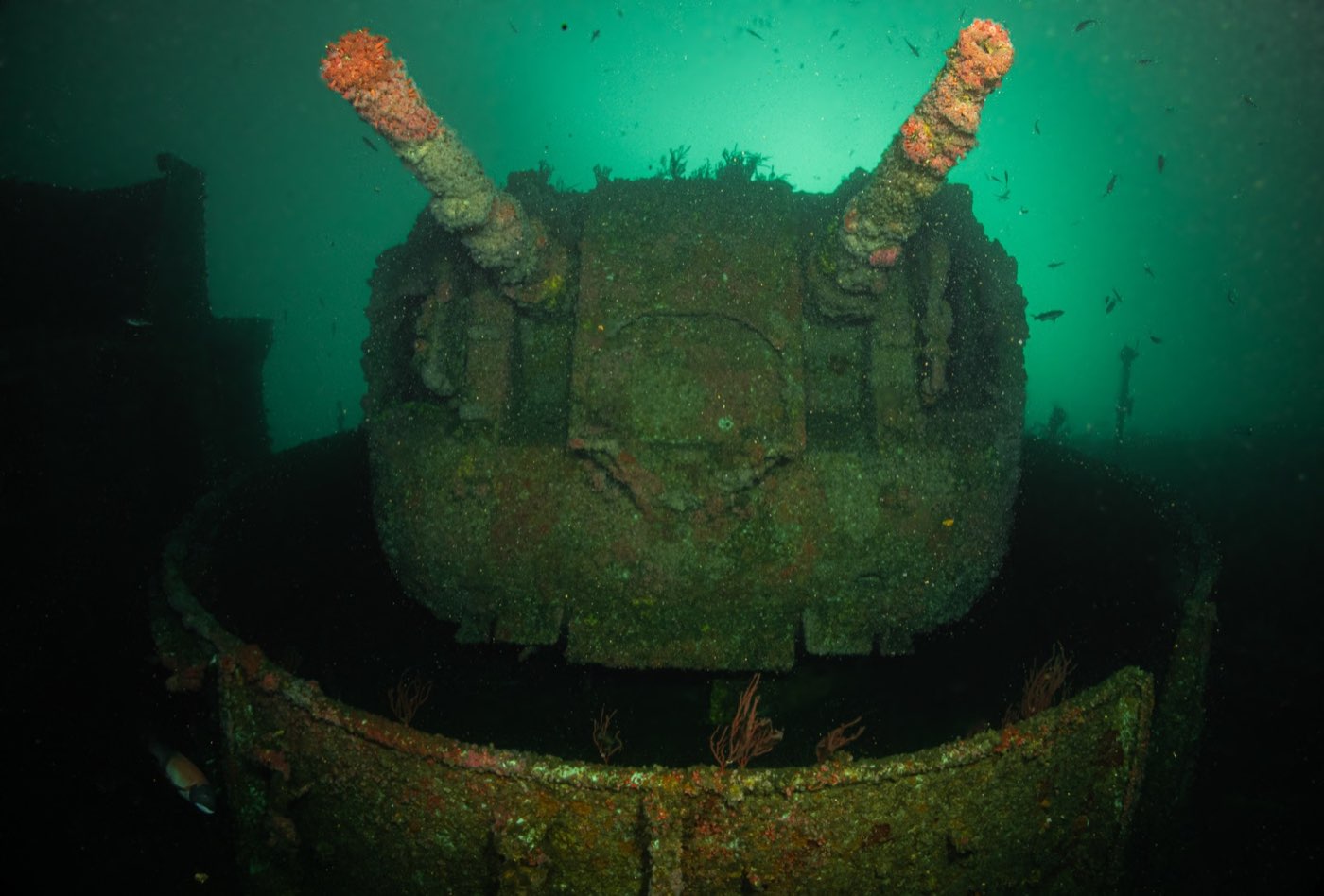
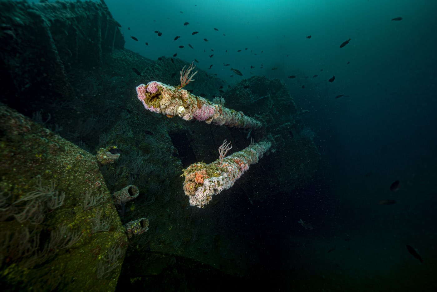
Preparing her took from May 1999 to July 2000. Environment Canada's standard governed the cleaning, and the San Diego Regional Water Quality Control Board added a requirement of its own: extra cleaning of oil residues from the machinery. The reduction gears came out and were cleaned. The engine-room drip pans were dropped. The forward boiler spaces were filled with concrete. The original gun barrels were replaced with lengths of pipe. Interior panels, bulkheads and doors that could trap a diver were removed, and roughly 20 feet of the aluminum signal mast came off, because a ship close to 100 feet tall sitting in 100 feet of water would have been a hazard to navigation.
Then the holes. The plan called for a diver to be within about 30 feet of an exit anywhere inside the ship, with two exits in view in most places, and for the cuts to let ocean currents flush the interior. Volunteers made most of the openings by hand. Milt Beard cut the majority with a gas torch through 3/8-inch steel and aluminum, and Navy personnel who were running shaped-charge training aboard did the charge work. Some of those openings created a 30-foot drop straight through the ship, which is why the project ran color-coded security badges for everyone who came aboard and restricted access for months until the volunteers knew her.
The final count was 116 openings, keyed to a map. That map deserves its own chapter, and it gets one below.
The ship paid for herself as she sat there. Enthusiasts toured her at $20 a head. Names went on an honor wall inside the ship for $100 each, and ten names together bought a family or club plaque. Sponsors could have a compartment named after them, from a small room at $10,000 to the largest room, a banner on the ship and a table for twelve at the sinking banquet at $50,000 and up. The Foundation sold valve handles, gun sights, keys and telephones off the ship, and sold shirts and hats. Girl Scout troops and children from SeaCamp painted murals inside several compartments, alongside a local artist whose name the recordings do not preserve clearly enough to print.
Choosing the spot
Site selection fell to John Boyer, who led the safety committee's site subcommittee. He started from surveys the Naval Ocean Systems Center had run in the late 1950s for the Navy Electronics Laboratory tower, which had mapped the bottom from about 60 feet out to the edge of the shelf, and from bathymetric charts. Using GPS, a team of divers found his first candidate and surveyed it to confirm the bottom was flat and bare of permanent marine life.
That site was deeper than 100 feet, and the San Diego Lifeguard Service turned it down. One hundred feet is the deepest lifeguards may dive to rescue someone, and the Lifeguards would not sign off on a wreck below their reach. The team chose and surveyed a second, similar spot in 100 feet of water, and that is where she lies.
On 10 January 1999, 22 divers swam the footprint for the environmental review. They found low numbers of sand stars, bat stars, Kellet's whelks, tube worms and sea pens, one sculpin, scattered clam shells and no live clams: a working sand bottom with nothing on it that a warship would crush. The site is about 4,500 feet west-northwest of the old NEL tower, on fine gray sand with ripple marks that grow to eight inches high in winter and flatten to two or three in summer.
The paperwork
The City of San Diego was the lead agency, and its Final Programmatic Environmental Impact Report for the San Diego Underwater Recreation Area and the Yukon Project, LDR No. 98-0686, was published on 3 September 1999. The California Coastal Commission took the project up at a hearing in February 1999. The Army Corps of Engineers, rather than issuing a standard artificial-reef permit, issued a Letter of Permission under the Rivers and Harbors Act, because the state had classed the site as an underwater recreation area rather than a Fish and Game reef. The Regional Water Quality Control Board certified her under Section 401 of the Clean Water Act after a final inspection. The National Marine Fisheries Service worked out a marine-mammal watch for the sinking. The Coast Guard issued a Marine Event Permit and handled the navigation buoys.
Marine biologists from the National Marine Fisheries Service, the state Department of Fish and Game and Scripps Institution of Oceanography looked at the site and concluded that a ship on that sand would displace about a quarter acre of worms, clams and starfish and would add hard structure that the region's fish were short of. The EIR is candid that the whole Southern California shelf is far sandier now than during the ice ages, when sea level was 100 meters lower and rocky bottom was common, and that a bight-wide habitat study had ranked shallow artificial reefs second only to kelp forests in value to fish.
Once sunk, the ship was to be given to the City. The EIR expected her to hold together for more than 50 years. It also set out how divers would use her: dive boats tying to mooring buoys attached to the ship, buoys off to the sides for additional boats, signs warning that the wreck is not maintained and that divers use her at their own risk, and a Coast Guard navigation marker with radar reflector, light and sound. The EIR planned the sinking for November 1999. The date slipped, and the Foundation moved the event to the following summer.
Paying for it
The economist who later studied the wreck, Linwood Pendleton of UCLA, recorded the Foundation's own cost figures: $238,000 to acquire the ship, $97,000 to prepare her and $100,000 for towing, mooring and the sinking, a little over $435,000. The Foundation's letter to the RAND Corporation in October 2000 gave a fuller accounting that included storage at the dock, insurance and the other costs of running the project for fourteen months: $799,136. Both numbers are in the record. The second is the one to use for what a ship like this costs a city, and the first for what she cost to buy and cut.
Part Four: The sinking (July 2000)
This is the chapter divers ask about on the boat.
The plan
The Foundation timed the sinking to an international conference it co-hosted with Diving Unlimited International at the Holiday Inn on the Bay: "Converting Unused Ships and Structures to Enhance Ocean Environments," 12 to 15 July 2000. Speakers came from Environment Canada, the Artificial Reef Society of British Columbia, Florida's artificial reef program and the U.S. Navy. The agenda gives an hour-by-hour timeline.
- Wednesday 12 July. Registration and tours of HMCS Yukon, still at the dock.
- Thursday 13 July, early morning. Yukon is towed to the site, 1.82 miles west of Mission Beach, and anchored bow and stern.
- Thursday 13 July, 06:00. A Coast Guard safety zone of 100 yards around the ship takes effect, to run until noon on Sunday 16 July, with the Lifeguard Service and Harbor Police enforcing it.
- Thursday evening. "Blowup Blowout: A Sinking Celebration," a public party ahead of the detonation.
- Saturday 15 July. The ceremonial sinking.
Demolition experts from San Diego and Canada were to fit six shaped charges below the waterline, three per side, each a bead of fast-burning cutting compound laid on a plywood template shaped to the inside of the hull, outlining a square about four feet on a side. On ignition each charge would cut the plate almost instantly, sea pressure would push the square inward, and water would pour in. The charges were sequenced bow to stern so she would flood forward first, touch the sand with her bow, and settle upright on her keel in three to five minutes, the way Mackenzie and Saskatchewan had. Fireworks on deck and in the guns would simulate a short naval battle for the spectator fleet.
The marine-mammal plan alone had five observation posts: two spotters on the mast, to be taken off twenty minutes before detonation, four boats inside the 100-yard zone, more boats in the viewing area between 100 and 500 yards, and a private aircraft patrolling two miles north, south and west and one mile east. Any whale, dolphin, sea lion or turtle inside 500 yards would stop the countdown until it left. A "First to Dive" event was organized for the moment she settled, with volunteer divemasters to guide the first divers down once a safety team had cleared the wreck.
What happened
Yukon never got to Saturday.
She was anchored at the site on Thursday 13 July. That evening an unexpected southern swell arrived with larger seas than forecast. Shifting wind and swell pushed water in through the diver openings already cut just above the waterline, holes meant to let divers in, not to sink the ship, and she began to flood. The Foundation's own ecological assessment records it plainly: "large seas swamped the vessel due to an unexpected southern swell and filled the hull with seawater. Because the Yukon took on too much seawater, she sank prematurely."
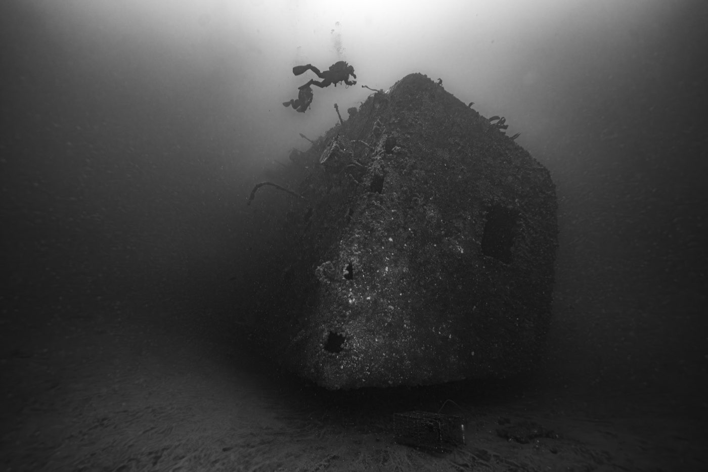
HMCS Yukon went down on Friday 14 July 2000, a day before her ceremony, without a single charge fired. Because she flooded unevenly instead of in the planned bow-first sequence, she rolled as she sank and came to rest on her port side, bow pointing north. She landed on the exact spot the site team had chosen. The volunteers who had spent more than a year inside her watched from boats. One Foundation representative, quoted in the television coverage, allowed that the ship had ended up "where she wants to be."
Some older dive-site write-ups, including our own, say she sank in "June of 2000." Every primary document says July, and the conference schedule pins the date to the day.
What changed because she went down early
The early sinking did three things to the dive.
It made her deeper. The Diver's Map had been drawn for an upright ship whose bridge would sit at about 35 feet. On her side, the shallowest point became about 55 feet depending on tide, and the Foundation's later training decks describe her as running "56 to 103 feet."
It left eight planned openings uncut. The six exterior holes on the port and starboard sides and the two forward interior holes on Decks 5 and 6 were the ones the shaped charges were supposed to make. They do not exist. Anyone navigating from the original map or from memory of the plan will find fewer holes than drawn.
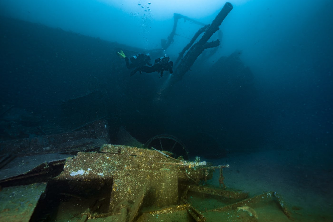
And it turned every corridor sideways. Passages designed to be swum horizontally now run up and down, floors are walls, and the interior no longer matches the openings cut for it. Abouna, who drew the map, noted that many divers feel she is more like a real wreck this way. The Foundation's own research divers, in a 2003 conference paper, called her "disorienting, extremely cold" with "heavy surge."
The RAND Corporation, writing for the U.S. Navy the following year, summed up the result from the business side: "By all reports, it was an instant success, swamping the diving and fishing businesses in the city during subsequent months." Local charter operators saw about a 60 percent increase in trips in the first year.
Part Five: How the wreck is laid out
Six decks on their side
Yukon has six decks plus the bridge. Abouna digitized every compartment from Society drawings, Foundation drawings and declassified Canadian Navy plans left aboard, none of which shared a scale or a coordinate system, so that the compartment walls, doorways and new openings would line up across decks. His table is the best description of her interior in print. The opening counts are as planned. Because eight were never cut, the real total is 116.
| Deck | Name | What it held | Compartments | Openings as planned |
|---|---|---|---|---|
| 01 | Bridge | Helm | 1 | 9 |
| 1 | Ops | Tactical operations | 14 | 16 |
| 2 | Main | Officers' quarters, communications | 34 | 31 |
| 3 | Burma Road | Ship's business, dining | 53 | 55 |
| 4 | Mess | Seamen's mess, engine and boiler rooms | 31 | 50 |
| 5 | Engine and Boiler | Engine and boiler rooms | 2 | 6 |
| 6 | Engine and Stores | Engine room, stores, magazines | 30 | 15 |
Two notes on the table. In Canadian and British usage "mess" means the sleeping space and "dining" the eating space, the reverse of the U.S. Navy. And the boiler room on Deck 5 was sealed before sinking so that no one could get into that confined space. It is closed by design, not an overhead environment that happens to be hard to reach.
Now rotate the whole table ninety degrees onto its port side. The starboard hull faces up and is the shallow side of the dive. The superstructure and the port side run down toward the sand. What used to be a deck is now a vertical wall, and what used to be a bulkhead is a floor or a ceiling.
The 116 openings and how they are numbered
Every opening carries a six-inch Lexan sign, riveted to the ship by volunteer Kai Schumann. The code on each sign is the same one printed on the Diver's Map, and it reads like this:
- The first character is the deck number.
- The second is P, C or S for port, center or starboard.
- The third is the sequence number of that opening along that side.
- A fourth character, V, means the opening can be swum vertically, through a floor or ceiling, rather than horizontally through a wall.
The signs were placed at the forward edge of every opening on purpose, so that in poor visibility a diver who finds a sign by sight or by touch knows which way the bow is.
Color was a problem the map had to solve. The original design used green hatched lines for horizontal openings and solid blue lines for vertical ones, and at the Yukon's depth both colors read as black. So the map was redrawn to carry the same information in text orientation, arrow shape and line type, and the signs followed suit. Laminated copies of the whole map, each marked "You Are Here," were riveted inside the ship behind Lexan.
Abouna printed the map onto two-sided polystyrene slates, 9.5 by 7.5 inches, small enough to carry and readable underwater because a mask makes things look a third larger than they are. Fourteen hundred slates sold at $10 each, and more than 400 shirts with the map on the back under the line "Loose Lips Sink Ships." He also presented the map and numbering system to the City Lifeguard Service before the sinking, so that a lost diver could be described by compartment and opening rather than by guesswork. By his estimate the ship takes as many as 30 dives to see in full.
Depths, feature by feature
Depth on the Yukon depends entirely on where you are on the ship. The numbers below come from three independent measurements: the Scripps ecological assessment, the Navy's 2002 sonar survey and the map-maker's account.
| Feature | Depth | Source |
|---|---|---|
| Sand under the port side, the deepest point | About 100 to 102 ft (30.5 to 31 m) | Scripps 2005, Navy sonar 2002, site selection 1999 |
| Starboard rail and bridge, the shallowest point | About 55 to 60 ft (17 to 18 m), varying with tide | Scripps 2005, Navy sonar 2002, Abouna 2001 |
| Starboard rail, mid to aft (research line C) | About 59 ft (18 m) | Scripps 2005 |
| Starboard side of the bridge (research line B) | About 66 ft (20 m) | Scripps 2005 |
| Aft deck, now vertical, farthest from the superstructure (research line D) | About 72 ft (22 m) | Scripps 2005 |
| Bow to the base of the bridge, beside the vertical deck (research line A) | About 82 ft (25 m) | Scripps 2005 |
| Bottom near the bow on one sonar pass | About 94 ft (28.4 m) | Navy sonar 2002 |
On the Marissa we brief the decks most divers spend their time on at 65 to 75 feet, with the sand at about 100. That is the figure in our own site records, and it sits between the shallow rail and the bottom for a reason: the main and Burma Road decks, now standing on edge, are where a two-tank profile spends its minutes.
The 2002 Navy sonar survey
On 29 March 2002 Rich Arrieta, an ocean engineer at the Space and Naval Warfare Systems Center in San Diego, used the Yukon as a training target for a REMUS unmanned underwater vehicle the lab called Albacore. Built at Woods Hole, the vehicle carried a 600 kHz side-scan sonar and an acoustic Doppler current profiler for bathymetry. Arrieta first flew it over a 200-by-200-meter box at seven meters' depth with five-meter lane spacing to fix the ship's position and bearing relative to the mooring, and to make sure the vehicle would not hit her. He then made two passes each at three, five and ten meters off the bottom.
The images show the superstructure, the stern with its rudder and propeller shafts clearly visible, and in the last pass the bulk of the ship and the full superstructure, which he described as looking almost ghostly. His notes record the ship in 102 feet of water on her port side with an average minimum depth along the starboard side of about 60 feet from bow to stern. The Scripps assessment reproduces one of these images, and it is the best top-down view of the wreck that exists.
Moorings and the research lines
When the Foundation was training research divers in 2005, three mooring buoys were on the ship. Buoy 1 led to the forward gun and research lines A and B. Buoy 2 led to the signal mast and lines B and C. Buoy 3 led to the mortar bay and lines C and D. The landmarks the training manual taught for navigating the outside of the ship were the bridge, the forward gun, the aft gun, the mortar bay, the cutout holes, and the white and blue signs.
Moorings on a wreck come and go with storms and budgets, and the Marissa's crew will tell you on the day where the line goes. The four research transects were 20-meter stainless cables installed by C&W Diving Services, marked with small lobster buoys, and scrubbed of algae every month by a local dive club so that volunteers could find them. Whether any of that hardware survives 21 years later is not recorded anywhere we have found.

Part Six: The reef (2001 to today)
The volunteers who counted the fish
No one surveyed the site scientifically before she sank beyond the January 1999 swim-over, so the classic before-and-after study was impossible. The Foundation's own scientist says as much. Several months after the sinking the Foundation started the Artificial Reef Monitoring Project instead, a volunteer program designed with Ed Parnell and Paul Dayton of Scripps Institution of Oceanography to measure how the ship was colonized over time.
The volunteers were not casual. To collect data a diver needed Rescue certification, 50 California or equivalent cold-water dives including 10 deeper than 80 feet and 6 on the Yukon herself, dive insurance, and a PADI specialty course written for the job, "Yukon Research Diver," with a pool session, two open-water dives, fish identification and the ship's own safety procedures. By 2003 the Foundation had trained more than 150 people through eight courses and 18 had completed the specialty. Fish counts began in late May 2001, eleven months after the sinking. A parallel fish-tagging study, meant to track movement between the Yukon, the other Wreck Alley wrecks and the natural reefs, was started and then dropped for lack of money.
The method was deliberately simple. Swim a 20-meter line slowly, about two minutes, and count everything in an imaginary tunnel ten feet to either side and ten feet up, by species and by size. Do not count if visibility is under about ten feet. Record the number of boats on the wreck, the number of other divers you see, the visibility, surge, temperature and current. Photograph 0.25-square-meter PVC quadrats fixed to the hull. The first 40 quadrats, glued on with splash-zone epoxy in 2002, all fell off within months. C&W Diving welded tabs to the ship and 22 went back on in 2003.
What the counts found
Parnell's report, dated 7 January 2005, covers 160 fish counts by 13 divers from May 2001 to August 2004. Nearly half were made by one diver and 80 percent by five. His statistics showed that the five experienced divers counted consistently with each other, and that the less experienced ones tended to overcount.
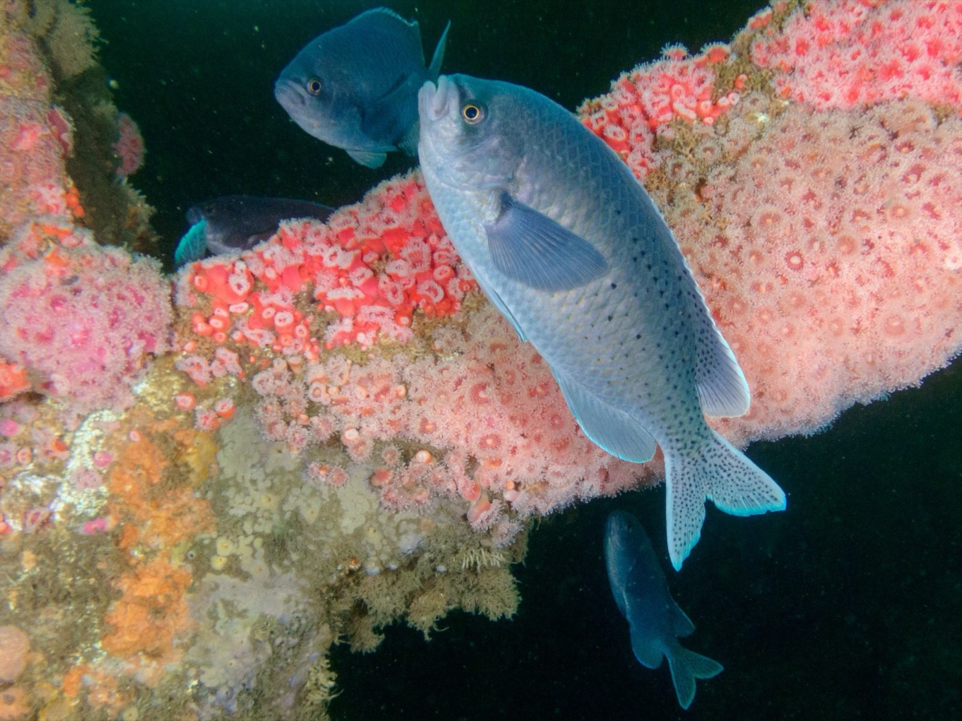
Pooling every count, the most abundant fish were, in order: white surfperch, blacksmith, black surfperch, juvenile bocaccio, vermilion rockfish, other rockfish, pile surfperch, blackeye gobies, barred sand bass, painted greenling, señorita, snubnose sculpin and California sheephead. Also recorded were rainbow surfperch, cabezon, kelp bass, rubberlip surfperch, lingcod, sculpin, giant kelpfish, rock wrasse, corbina and barred surfperch. Divers reported an occasional giant sea bass, and two broomtail groupers were seen inside the ship on several occasions. California halibut and speckled sanddabs were common on the sand beside the hull and under the stern. Parnell himself, on three dives in June 2004, added gopher, calico, copper and brown rockfish, island kelpfish, sargo and kelp surfperch to the list.
The fish community changed as the years went on. The first arrivals, in the second year after sinking, were black and pile surfperch, blacksmith, barred sand bass, sculpin, sheephead and cabezon, most of them adults that had swum in from elsewhere. Later came white surfperch, painted greenling, blackeye gobies, kelp bass, bocaccio, rainbow surfperch, vermilion rockfish and lingcod. By 2003 and 2004 the mix had stabilized. Counts were higher in summer and fall than in winter and spring, and higher when visibility was better and when fewer other divers were in the water. His regression put it in one line: total fish equals 85.6, minus 15.7 for every other diver seen, plus 13.0 for every meter of visibility.
Two findings matter most. Young-of-the-year sheephead and bocaccio, both heavily fished species, were found on the wreck, meaning the Yukon is nursery habitat for them, and bocaccio was a seriously depleted species at the time. And the ship turned out to be good habitat for vermilion rockfish and bocaccio, fish that are rare in the kelp forests and common along the rim of La Jolla Canyon. Parnell's conclusion was that the Yukon provides a hybrid of deep kelp-forest habitat and canyon-rim habitat, and that the whole Wreck Alley network may act as stepping stones for mobile fish moving between the La Jolla kelp two kilometers to the north and the Point Loma kelp forest six kilometers to the south.
The comparison with nature was sobering. Fish diversity on the Yukon in 2004 was 1.16 on the Shannon index against 2.00 on high-relief deep reef inside the La Jolla kelp forest, about half. The kelp bed was better for kelp bass, barred sand bass, rockfish and sculpin. The Yukon was better for cabezon and lingcod. Sheephead liked both equally. Diversity was rising slowly, and Parnell expected it to keep rising, but he warned against assuming a 100-foot-tall ship is better fish habitat than a low rock pile just because it is tall: fish abundance in Southern California saturates at about three quarters of a meter of relief.
What grows on the steel
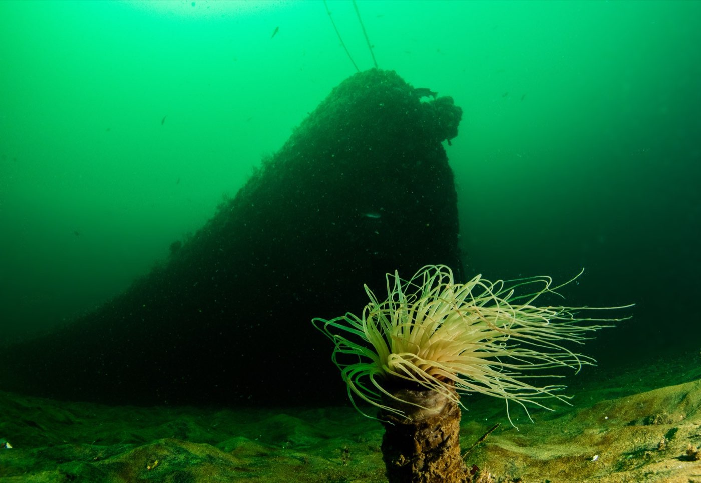
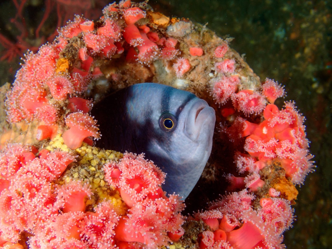
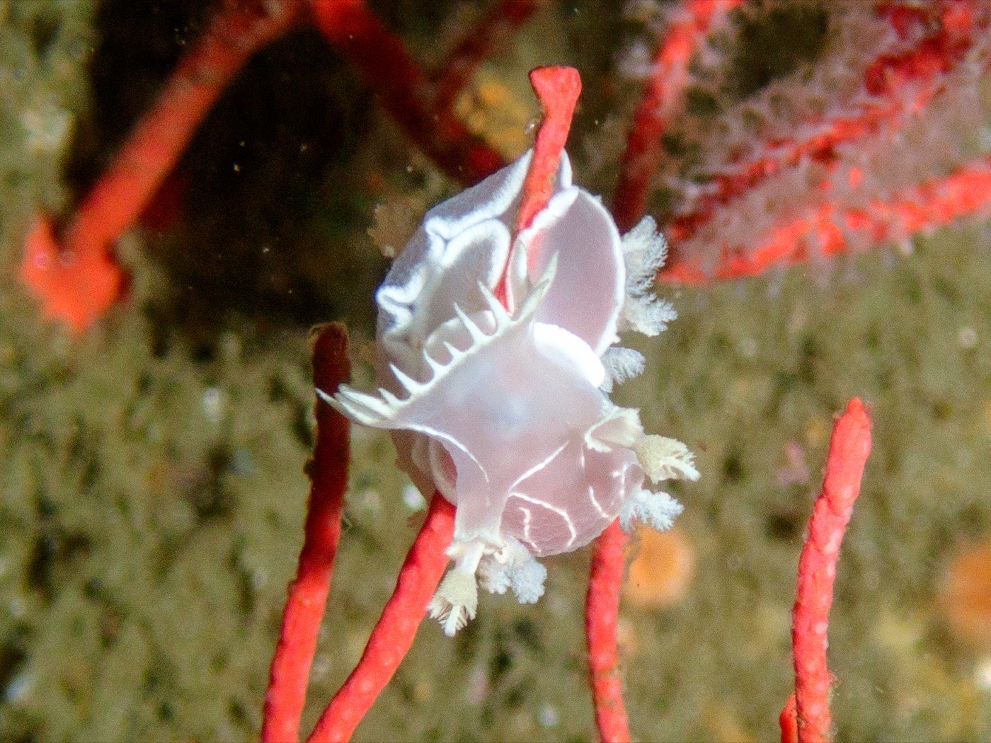
In 2005 the hull was carpeted in two anemones, the white plumed Metridium and the strawberry anemone Corynactis californica. Vertical surfaces were dominated by Corynactis, stalked tunicates, the colonial tube worm Salmacina and the bryozoan Bugula. Horizontal surfaces grew algae, Corynactis, the encrusting tunicate Archidistoma and tube-building worms and snails. Horizontal surfaces also carried more bare space, partly from divers' fins, partly because some of the hull was still coated in working antifouling paint that kept everything but diatoms and hydroids off it, four and a half years after sinking. The photo-quadrat invertebrate list ran to more than 60 species: sponges from red volcano to cobalt, giant acorn barnacles, rock scallops, sheep crabs, bat stars, sunflower stars, red and purple urchins, Kellet's whelks, Hermissenda and other nudibranchs, orange cup coral, tube anemones and Christmas tree worms among them.
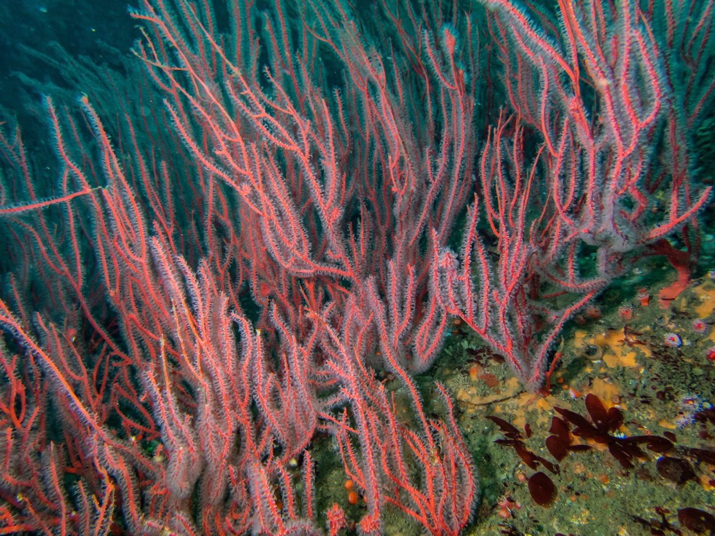
What was missing told Parnell the reef was young. Late-succession species, gorgonians in particular, had not yet arrived, and turf algae had not formed. By the standards of other Southern California artificial reefs the fouling community was, in his words, "not yet successionally mature."
Kelp that cannot hold on
Giant kelp, elk kelp, palm kelp and several smaller kelps all recruited to the Yukon in the quadrat photos. Almost none survived six months. The oldest giant kelp Parnell found on the ship was at the four-stipe stage, under six months old. Elk kelp could not stay attached beyond a couple of meters in length. Hydroids and bryozoans smothered young brown algae far more heavily than on natural reef. The reason is the hull itself: a smooth painted steel plate gives a holdfast nothing to grip, and Parnell found that very little tension pulls a young kelp free. Unless someone bolts rough substrate to her upper surfaces, the Yukon will not grow a kelp forest, and even then the bryozoan fouling might invite grazing fish to finish the job.
What the fish tell us about fishing
The Yukon has no protection. The seafloor belongs to the City, the reef is administered by the state, and the underwater recreation area was created without a no-take rule. The EIR expected about 40 lobster traps around her each season from October through March, based on the other wrecks, and sportfishing for sand bass, sculpin and sheephead.
Parnell documented what that means for a reef the size of a ship. Commercial passenger fishing vessels fished the Yukon several times during the study, and after those episodes the barred sand bass, a slow-maturing species, looked noticeably depleted. Adult sand bass, sculpin, cabezon, kelp bass, rockfish and lingcod had migrated onto the ship from elsewhere, and a small, well-known, high-relief structure concentrates fish where they are easiest to catch. Whether the Yukon and the rest of Wreck Alley add fish to the region or only gather them from natural reefs is a question the study was not funded to answer, and Parnell said so. Dick Long, in his 2004 talk on how to bring a warship to your own coast, made the divers' case for no-take zones around reefed ships in one sentence: you can take a fish's picture a thousand times, but you can only eat it once.
What the Marissa's cameras see now
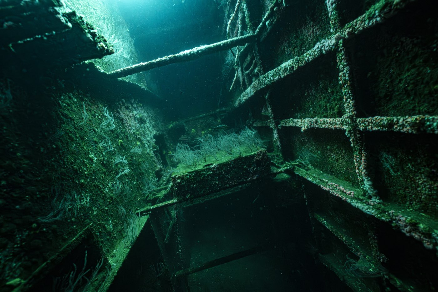
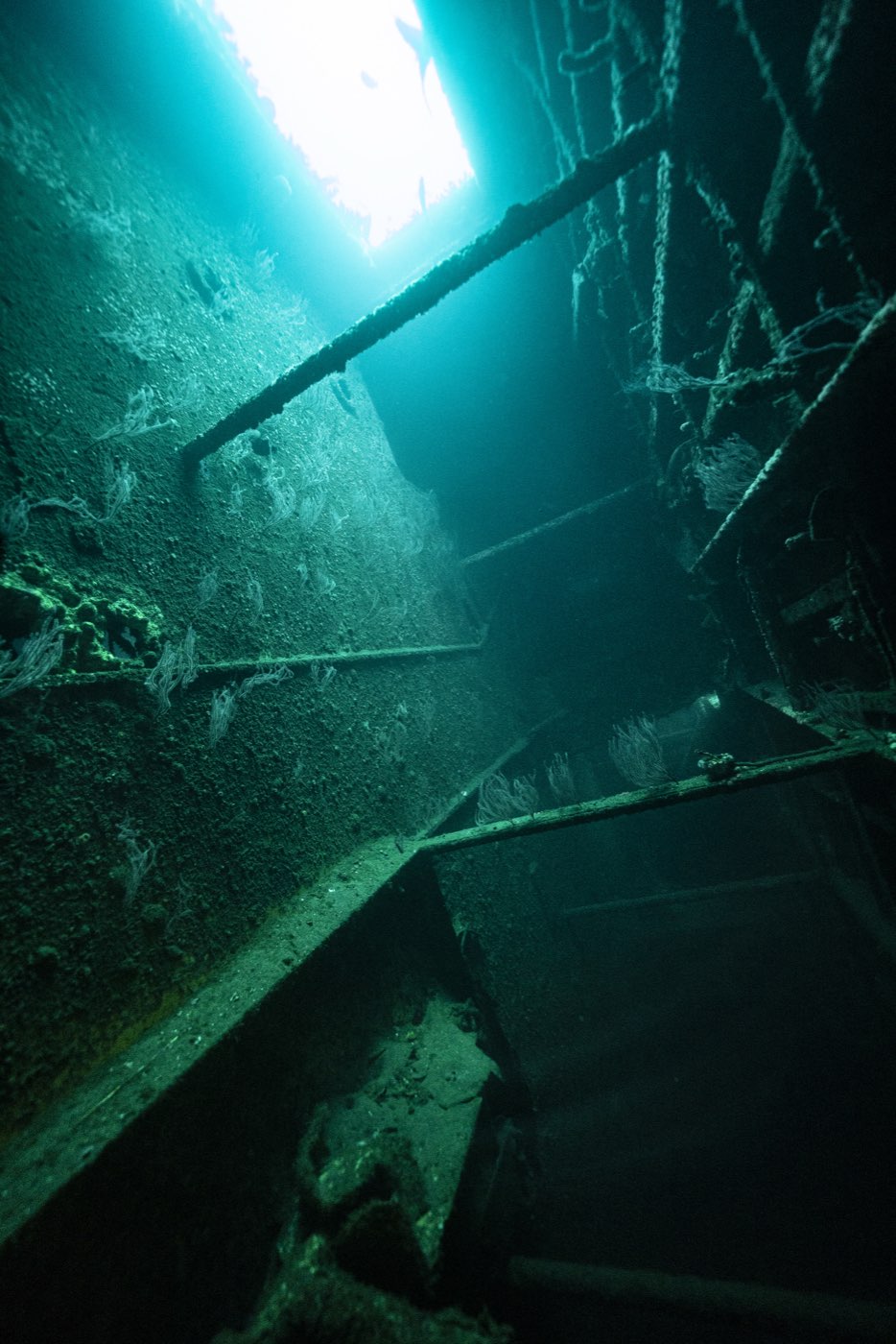
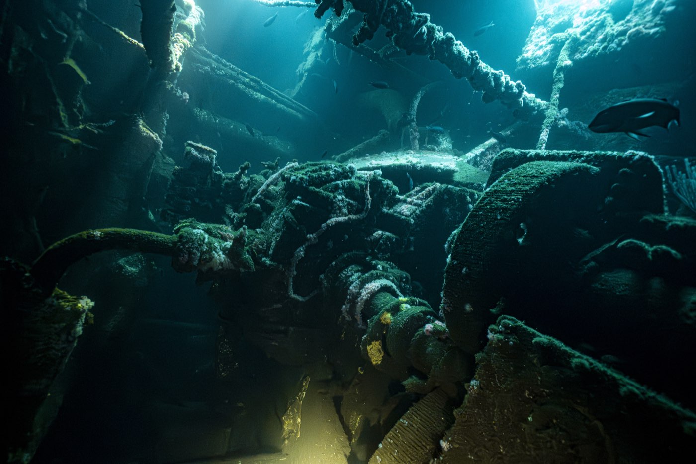
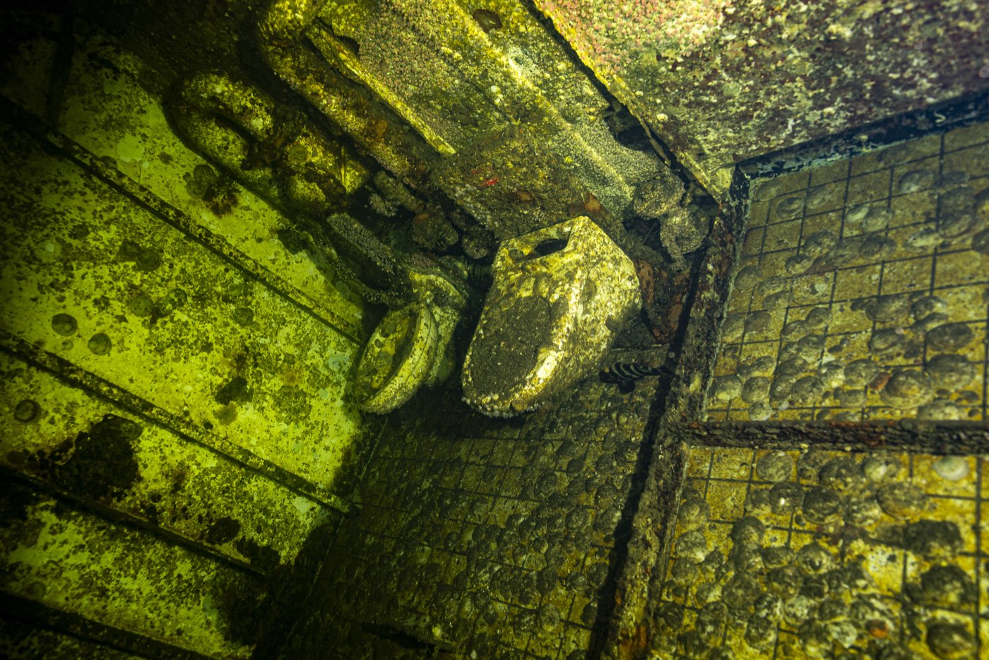
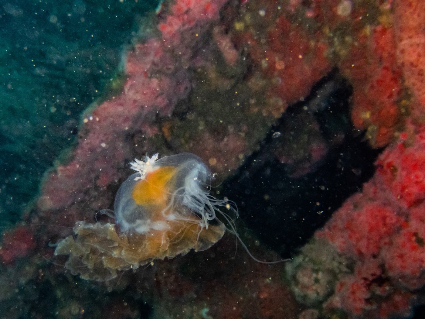
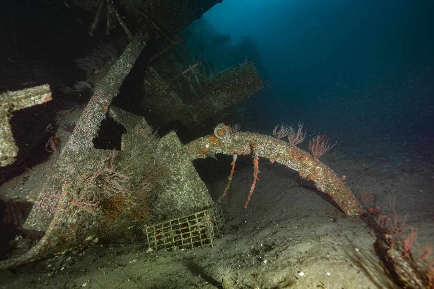
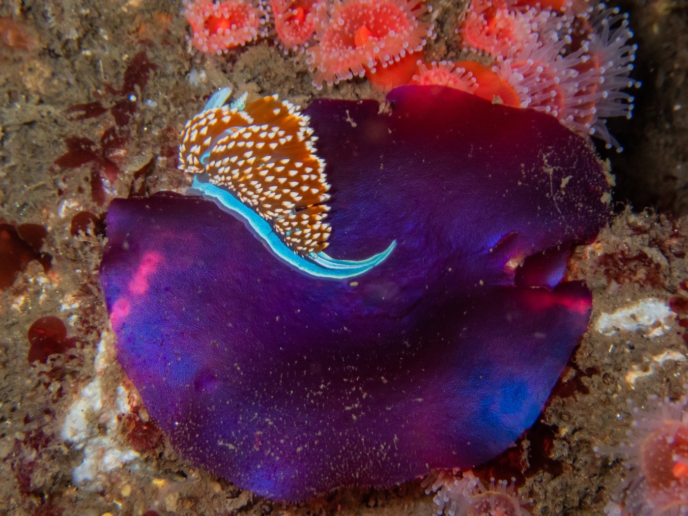
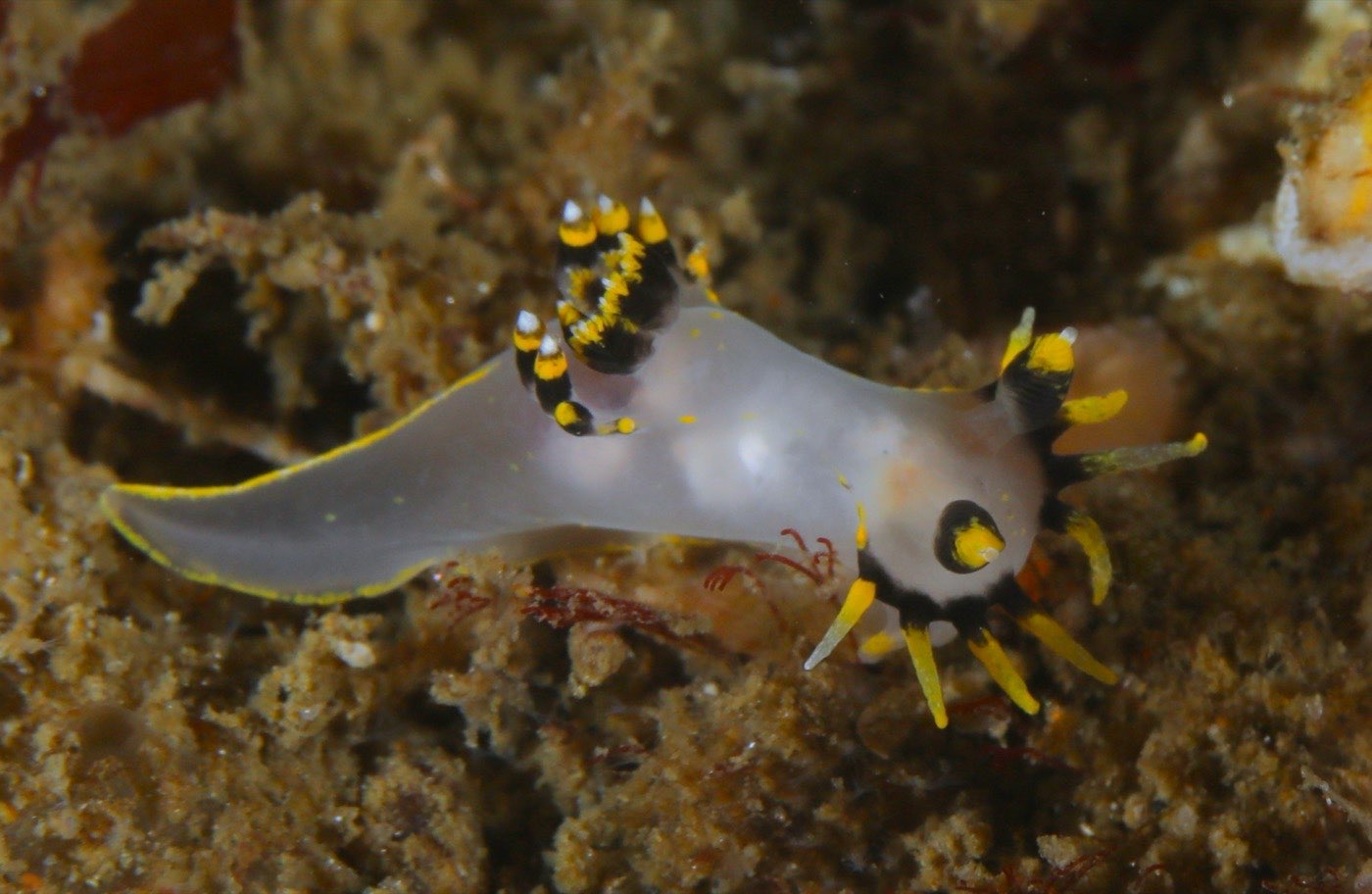
The most recent published science on the Yukon is that 2005 report, and it describes a reef in its fifth year. She is in her twenty-seventh. The photographs on this page are the record of what has changed, taken on our own trips by the divers named under each one.
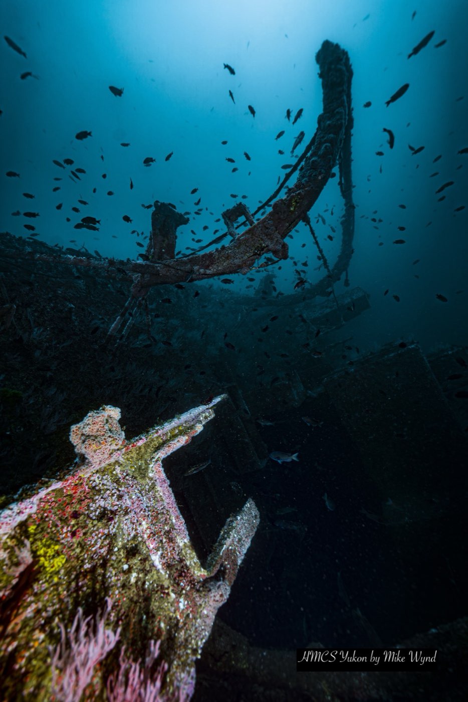
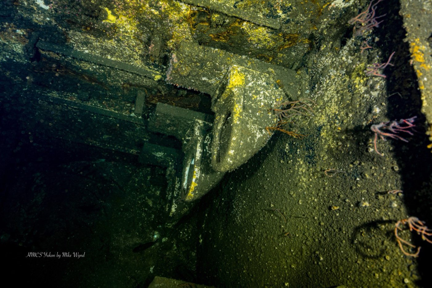
The gorgonians Parnell was waiting for have arrived. Callie Mack's stand of red gorgonians is growing on steel that carried none in 2005. The strawberry anemones still ring the beams and the openings, and blacksmith and blue rockfish hold over them in the water column. California morays live in the structure. Hermissenda, Spanish shawl and white nudibranchs work the gorgonians and the algae. Jellies drift through the openings, and a school of blacksmith fills the dolphin-shaped cutout in the hull when the sun is behind it. Whether the antifouling paint has finally given up its last bare patches is a question for the next scientist who counts, but the wreck in these pictures is a mature reef by any measure Parnell used.
Part Seven: What the Yukon did for San Diego
The divers came
The Foundation's own estimate was 26,700 dives on the Yukon in 2003. Divers surveyed on the boats averaged 2.45 dives a day on her, which works out to about 10,800 dive trips that year, and just over 55 percent of the 814 divers who filled in the Foundation's 2002 and 2003 surveys lived outside San Diego County. The Foundation's other estimate, for August 2002 to August 2003, was 10,000 divers making 26,000 visits. Waiver records from one charter boat showed the same pattern: for the years 2001 through 2003, that one boat alone logged between 1,232 and 1,699 Yukon dive waivers a year.
The numbers
Pendleton's 2005 study for the Foundation, funded by the California Artificial Reef Enhancement Program, put dollars on those dives. Divers spent an average of $95 a trip on the dive itself, charter, fills and the rest. Out-of-county divers spent another $580 a day on lodging, food, drink and shopping. Scaled to 2003's traffic, that was roughly $4.5 million a year into the San Diego economy, about $1 million of it on dive charters and tank fills, supporting somewhere between 37 and 66 full-time jobs on the boats and around 225 more in hotels and restaurants. On top of that, a travel-cost model on the waiver data found divers valued a day on the Yukon at about $110 more than they paid for it, a non-market value of about $1.2 million a year.
Pendleton was careful about the limits. The survey was unfunded and handed out by dive operators rather than sampled at random, so the totals are illustrations, not audited figures. His conclusion still stands: the wreck was returning many times its cost every year, against about $1,000 a year in basic maintenance. Charter operators in the 2001 GIS article had already seen roughly a 60 percent rise in business in the first year, against a pre-sinking projection of $1 million a year in new tourism revenue.
A model other cities copied
The Yukon was the first major warship scuttled for divers in California, and at the time the state had ten ships down as diving reefs against Florida's 380. In 2001 the RAND Corporation's study for the U.S. Navy, "Disposal Options for Ships," put three photographs of the reefed Yukon by Bob Willey of the Foundation on its cover, barnacles on the hull, the forward gun, the depth marks, and used the Yukon and her sisters as cost cases. RAND concluded that reefing the Navy's inactive fleet would cost the taxpayer far less than scrapping it, and Abouna quoted the comparison for roughly 350 ships: about $1.2 billion to scrap, about $500 million to reef.
Congress followed. The Fiscal Year 2004 National Defense Authorization Act gave the Navy and the Maritime Administration authority to donate ships to states for reefing, and a Federal Reef Team was assembled to review applications. The first warship offered under it was the carrier Oriskany. The Vandenberg, off Key West, was the next big project in the pipeline when Dick Long stood up at the 2004 DEMA show in Houston to give a talk called "Bring a Warship to a Dive Site near You," built on what the Foundation had learned the hard way, including the lesson that volunteers cutting a warship would no longer be allowed under federal rules. A speaker from Florida's program had put it another way at the 2000 conference, suggesting that if San Diego followed the Florida custom of renaming a reefed ship, the right name would be the "You Can," for what a room full of volunteers had managed to do.
Part Eight: Diving the Yukon today
Everything in this chapter is how the Marissa runs the dive. The live briefing on the boat takes precedence over anything written here.
Depth and certification
The Yukon is an advanced dive. You need current Advanced Open Water certification or the equivalent, and we recommend 15 to 20 logged cold-water dives before you go down on her. The sand is at about 102 feet, the starboard rail at 56 to 60, and the decks most people swim at 65 to 75, so a two-tank Wreck Alley day puts most of your time between 60 and 100 feet. If you have not dived cold water or low visibility off a California boat in a while, say so before you book. The Ruby E and several kelp sites are Open Water friendly, so there is usually a way to get you on the water at the right level. The longer answer is at Do you need Advanced Open Water to dive the Yukon?
Cold, dark, and worth a light
Plan on 50 to 52°F at depth for most of the year and colder in late winter. A 7 mm suit with hood, gloves and boots is the minimum, and a drysuit if you are trained in one. Choosing between the two is answered at Drysuit or 7 mm wetsuit for diving San Diego? Visibility on the Yukon swings from excellent to almost nothing and changes week to week. The Foundation's research divers were told not to count fish below about ten feet of visibility, which tells you how low it can go.
Carry a primary light even with no penetration planned. The Metridium and strawberry anemones on the hull only show their color under a beam, and the signs on the openings were redesigned in 2000 precisely because color vanishes at this depth. A DSMB and spool, a cutting tool for fishing line and a compass all earn their place on this wreck.
Going inside
She was prepared for penetration, with 116 marked openings and a plan that kept an exit within about 30 feet of anywhere inside. She was prepared for an upright ship. On her side the passages run the wrong way, some openings drop 30 feet, eight planned openings were never cut, and the boiler room is sealed. Go inside only with wreck or overhead training, the right kit and a planned continuous guideline. An opening you can see is not permission to swim through it.
Per Coast Guard rules our divemaster stays aboard, so you dive with your buddy. Solo-certified divers dive solo. Everyone else dives the buddy system, and we pair people up before we leave the dock rather than on the swim step.
Nitrox
The Yukon is a repetitive deep dive, which is where nitrox earns its keep. We blend it onboard at 22 to 40 percent, and the Marissa is the only San Diego dive boat that blends on the water. Nitrox extends your no-decompression limit. It does not change your depth limit. Plan the dive, watch your MOD, dive the plan. Whether it is worth the fill on this wreck is answered at Is nitrox worth it on the Yukon?
Fishing gear and traps
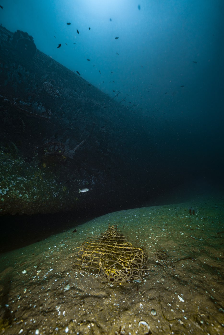
The site is fished. Expect monofilament on the structure year round and lobster traps and lines around the hull from October into March. Stay off the trap lines, carry something that cuts, and leave the traps alone.
Getting there
Wreck Alley trips board at the Mission Bay Sports Center, 1010 Santa Clara Place, San Diego, CA 92109, at 8:00 in the morning. Parking is free. Boarding time is not departure time: we pull off the dock once everyone is aboard, kit is mostly assembled and the briefings are done. The run to the wreck is short. The Yukon sits two miles off the beach, and the Ruby E and El Rey lie about half a mile south of her, which is why a Wreck Alley day pairs her with one of them. The price, dates and what the ticket includes are on the Wreck Alley trip page, and the calendar on the homepage shows the next open seats.
Diving the Yukon: questions we get on the boat
- Where is the HMCS Yukon wreck?
- About 1.85 miles west of Mission Beach, San Diego, at the north end of Wreck Alley, in the San Diego Underwater Recreation Area. She lies roughly 2 km south of the La Jolla kelp forest and 6 km north of the Point Loma kelp forest, in about 102 feet of water. The Ruby E and El Rey are about half a mile south of her.
- How deep is the Yukon?
- It depends on where you are on the ship, because she lies on her port side. The sand under her is about 102 feet (31 m). The exposed starboard rail and bridge, the shallowest points, sit around 56 to 60 feet (17 to 18 m) depending on tide. The main decks most divers swim are about 65 to 75 feet. A two-tank day on her spends most of its time between 60 and 100 feet.
- When did the HMCS Yukon sink?
- On Friday 14 July 2000, a day before her scheduled ceremonial scuttling. She was anchored at the site on 13 July waiting for shaped charges to be fired on Saturday 15 July. An unexpected southern swell flooded her through the diver openings already cut just above the waterline and she went down early, with no charges fired. Older copy that says June 2000 is wrong.
- Why is the Yukon lying on her side?
- Because she flooded unevenly through her diver openings instead of sinking in the planned bow-first sequence. Six shaped charges were supposed to cut four-foot holes below the waterline, three per side, so she would flood from the bow and settle upright on her keel in three to five minutes, the way her sisters Mackenzie and Saskatchewan did in British Columbia. She never got that far. She rolled as she sank and came to rest on her port side with her bow pointing north, on the exact spot chosen for her.
- What kind of ship was the HMCS Yukon?
- A Mackenzie-class destroyer of the Royal Canadian Navy, pennant DDE 263, built for anti-submarine warfare. The Navy's own designation for the class was destroyer escort, which is what the DDE stands for. Her keel was laid at Burrard Dry Dock in North Vancouver on 25 October 1959, she was launched on 27 July 1961 and commissioned on 25 May 1963. She spent most of her career as a training ship out of CFB Esquimalt and was decommissioned on 3 December 1993. She is 366 feet long with a 42-foot beam.
- How did the Yukon get to San Diego?
- The San Diego Oceans Foundation bought her from the Artificial Reef Society of British Columbia after the U.S. Navy declined to release an American ship. She was towed south in May 1999. The tow line parted off San Francisco in 25-foot seas and she drifted for a day and a half before a new line was secured. She arrived in San Diego Bay on 6 May 1999 and spent 14 months at the dock being cleaned, cut and mapped by volunteers.
- Can you dive inside the Yukon?
- Only with wreck or overhead training, the right equipment and a planned continuous guideline. She was cut with 116 marked openings so a diver would be within about 30 feet of an exit anywhere inside, but that plan assumed an upright ship. On her side the passages run the wrong way, some openings drop 30 feet, eight planned openings were never cut and the boiler room is sealed. There is a full ship to see from the outside. An opening you can see is not permission to swim through it.
- What do the numbers on the Yukon's openings mean?
- Every opening carries a six-inch Lexan sign riveted at its forward edge. The first character is the deck number, the second is P, C or S for port, center or starboard, the third is that opening's sequence number along that side, and a fourth character V means the opening can be swum vertically. The signs sit at the forward edge so that a diver who finds one in poor visibility knows which way the bow is.
- What will I see on the Yukon?
- A 366-foot warship that has been growing into a reef since 2000. Scripps counted 13 common fish species on her by 2004, led by white surfperch, blacksmith, black surfperch, juvenile bocaccio and vermilion rockfish, with sheephead, sand bass, painted greenling and lingcod behind them, and found her hull carpeted in Metridium and strawberry anemones. Our own photographs now show red gorgonians, California morays, nudibranchs and schooling blacksmith on her. Marine life is never a promise, and visibility on the Yukon swings from excellent to almost nothing.
- What certification do I need to dive the Yukon?
- Current Advanced Open Water certification or the equivalent, and we recommend 15 to 20 logged cold-water dives before you dive her. Water at depth runs about 50 to 52°F for most of the year, so a 7 mm suit with hood, gloves and boots or a drysuit is the minimum. If you have not dived cold water or low visibility off a California boat recently, tell us before you book and we will talk it through.
- Is the Yukon a protected site?
- No. The seafloor belongs to the City of San Diego and the reef is administered by the California Department of Fish and Wildlife, but the underwater recreation area was created without a no-take rule. The wreck is open to sport fishing and to commercial lobster trapping from October into March, so expect fishing line on the structure and trap lines around the hull in season.
- How do I dive the Yukon with Marissa Charters?
- The Yukon is the centerpiece of our Wreck Alley trips, which board at 8:00 am at Mission Bay Sports Center, 1010 Santa Clara Place, San Diego, and pair her with the Ruby E or the El Rey. The Wreck Alley trip page carries the price and what the ticket includes, and the calendar on the homepage shows the next open seats.
Sources
Primary documents from the project
- City of San Diego. San Diego Underwater Recreation Area and the Yukon Project, Final Programmatic Environmental Impact Report, LDR No. 98-0686. 3 September 1999. Includes the responses to comments dated 10 September 1999.
- San Diego Oceans Foundation and Diving Unlimited International. Artificial Reef Conference 2000: Converting Unused Ships and Structures to Enhance Ocean Environments. Proceedings, San Diego, 12 to 15 July 2000. Includes Dick Long's "Why Project Yukon?" and "Yukon Project Management Declaration," John Boyer's "Organizing the Safety Committee," the Project Yukon Sinking Safety Protocols, and the Project Yukon business and sponsorship plan.
- Abouna, Andrew G. "Map the Yukon: A Warship Becomes an Artificial Reef." Geospatial Solutions, October 2001, pp. 24 to 29.
- Arrieta, Rich. Side Scan Survey of the Yukon off Mission Bay. Space and Naval Warfare Systems Center, San Diego. Survey of 29 March 2002.
- Morris, Noelle. "Yukon Artificial Reef Monitoring Project: Data Collection Using Volunteer Research Divers." Paper and slides, Oceans 2003 Conference, San Diego.
- Parnell, Ed. Ecological Assessment of the HMCS Yukon Artificial Reef off San Diego, CA (USA). Scripps Institution of Oceanography, for the San Diego Oceans Foundation, 7 January 2005.
- Pendleton, Linwood H. Creating Underwater Value: The Economic Value of Artificial Reefs for Recreational Diving. UCLA, for the San Diego Oceans Foundation, 12 December 2004.
- Pendleton, Linwood H. Towards a Better Understanding of the Economic Value of Ships to Reef Scuba Diving in Southern California. UCLA, for the San Diego Oceans Foundation, 2 January 2005.
- San Diego Oceans Foundation. Artificial Reef Monitoring Project: Volunteer Manual. 2005.
- San Diego Oceans Foundation orientation and training video transcripts, including Al Bruton's history of the sinking and the television coverage of the event.
The wider ships-to-reefs record
- Hess, Ron, Denis Rushworth, Michael V. Hynes and John E. Peters. Disposal Options for Ships. RAND National Defense Research Institute, MR-1377, 2001.
- Long, Dick. Bring a Warship to a Dive Site near You. Transcript and slides of the presentation at the 2004 DEMA Show, Houston. San Diego Oceans Foundation, October 2004.
- DEMA ShipsToReefs Program. A Roadmap to Reefing. Circa 2004.
- Johnston, R.K., et al. "Assessing the Ecological Risk of Creating Artificial Reefs from ex-Warships." Space and Naval Warfare Systems Center and South Carolina Department of Natural Resources. Not Yukon-specific.
Naval service history
- Wikipedia entries for HMCS Yukon (DDE 263), HMCS Mackenzie (DDE 261), HMCS Saskatchewan (DDE 262) and HMCS Qu'Appelle (DDE 264).
- Naval Encyclopedia, "Mackenzie-class destroyer (1961)."
- readyayeready.com, "Ships of the Royal Canadian Navy: HMCS Yukon." Used with caution, because it carries the 1992 decommissioning date attributed here to a mix-up with Qu'Appelle.